


Poster Presentations
Description
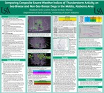
Poster for the Honors Thesis project.
Sea breezes (SB) occur frequently from May through October along the U.S. Gulf of Mexico Coast. One reason why SBs interest forecasters is their ability to spawn summertime thunderstorms, which can cause flash flooding, lightning, and hail. However, forecasting the exact timing and location of SB-driven convection can be challenging. This thesis will focus on Mobile and Baldwin Counties in southwest Alabama, which experience two types of phenomena – SBs along the Gulf of Mexico Coast and bay breezes on either side of Mobile Bay. Over the past years, multiple undergraduate students have analyzed Mobile, Alabama radar imagery of past SB seasons and categorized each day between May 1st and October 31st into one of four categories: Dry SB Days, Convective SB Days, Dry Non-SB (NSB) Days, and Convective NSB Days. Atmospheric balloon (or sounding) data from Slidell, Louisiana is also archived and available from the Wyoming Weather Web (http://weather.uwyo.edu/upperair/sounding.html). Severe weather indices (SWI), which are used to predict the likelihood of thunderstorm formation, can be calculated from sounding data. Using a ten-year archive of SB seasons, we calculated composite (or average) SWIs for each of the four categories by reading in individual soundings from the ten-year archive.
Publication Date
5-2022
City
Mobile
Keywords
sever weather indices, thunderstorms, Mobile Bay, sea-breezes
Disciplines
Atmospheric Sciences | Earth Sciences | Meteorology | Oceanography and Atmospheric Sciences and Meteorology | Other Earth Sciences | Other Oceanography and Atmospheric Sciences and Meteorology
Recommended Citation
Seiler, Elizabeth, "Comparing Composite Severe Weather Indices of Thunderstorm Activity on Sea-Breeze and Non-Sea-Breeze Days in the Mobile, Alabama Area" (2022). Poster Presentations. 3.
https://jagworks.southalabama.edu/honors_college_posters/3
Included in
Atmospheric Sciences Commons, Meteorology Commons, Other Earth Sciences Commons, Other Oceanography and Atmospheric Sciences and Meteorology Commons